
As winter tightens its grip on the United Kingdom, forecasters and weather enthusiasts alike are watching closely as snow and cold air threaten to reshape conditions ahead of the Christmas holiday. With discussions about a potential white Christmas entering everyday conversations and the Met Office issuing warnings for wintry weather in some areas, many residents are curious about what the coming weeks might bring. This article breaks down the latest updates on forecast models, snowstorm expectations, travel concerns, and the real possibility of seeing snow over the festive period in the UK.
What the Met Office Is Saying About Winter Conditions
The UK’s official weather service, the Met Office, has offered its latest long-range outlook for this winter season. Temperatures are expected to fall during the Christmas period, moving away from the mild conditions seen earlier in December. Forecasters predict that daytime values on Christmas Day will remain around 5–7 °C (41–44 °F) across much of the UK, which is significantly lower than recent weeks but not cold enough to guarantee widespread snow. There is still “just a chance” of snow or wintry flurries in some southern and coastal areas, though forecasters caution this would likely consist of light sleet or wet snow rather than heavy accumulations.
Defining a White Christmas in the UK
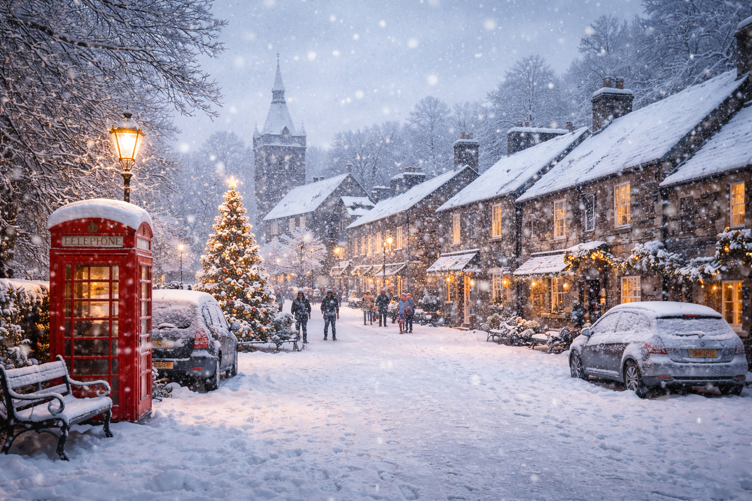
When people talk about a white Christmas, they often imagine a blanket of snow covering rooftops and streets on December 25th. However, meteorologically speaking, the definition is far simpler: if at least one snowflake falls anywhere in the UK during the 24 hours of Christmas Day, it counts as a white Christmas. This minimal threshold means that technically, even the briefest snow shower would classify as “white”. Yet experts note that significant snowfall that accumulates on the ground is much rarer and isn’t expected in most populated regions this year.
Forecast Models and Snowstorm Predictions
Beyond the official Met Office outlook, various weather models and forecast maps have been circulating suggesting an Arctic air mass could push significant snowfall into parts of the UK in the run-up to Christmas. Some projections indicate that snowfall could persist for multiple days in higher-lying regions of Scotland starting around December 20th, which increases the likelihood of wintry scenes for residents in the Highlands and Grampian Mountains. These maps show persistent snow for up to nine days in those areas, although this scenario does not necessarily imply heavy snowfall across all parts of the UK.
Other forecasting sources have hinted at the possibility of several snowstorm events before Christmas, driven by an Arctic blast moving across the UK. These storms could bring intermittent snow, sleet, and cold fronts that swing through different regions at different times. While these projections are helpful guides, weather models can change, and actual impacts may differ as systems evolve.
Which Regions Have the Best Chance of Snow
If snow does fall this winter, higher ground and northern areas generally have the greatest likelihood. Scotland, particularly the Highlands and parts of the northeast, tends to see snow earlier and more frequently than southern regions. Models suggest that these areas could experience persistent snow showers with potential for accumulation in the days leading up to Christmas. Northern England, parts of Wales, and Northern Ireland may also see snow at times, especially where cold air collides with moisture from Atlantic weather fronts.
In contrast, southern areas like London and the southeast of England are less likely to see significant snow, though a wintry flurry or sleet is still possible. Even if snowflakes fall here, they may not settle on the ground, meaning the classic picture-postcard snow scene is more likely further north and on higher ground.
Why Snow Is Harder to Predict in the UK
The UK’s weather is influenced by a complex mix of factors, including the Atlantic jet stream, North Atlantic Oscillation, and interactions with Arctic air masses. Because the UK sits at the meeting point of maritime and continental weather patterns, small changes in the jet stream’s position can dramatically alter whether rain, sleet, or snow develops. This complexity makes seasonal forecasts challenging and means that slight changes in temperature or moisture can determine if precipitation falls as rain or snow.
Additionally, long-range forecasts—those that consider weather weeks in advance—become less certain the farther out they look. While many models hint at colder and potentially snowier conditions, these are probabilistic predictions rather than guarantees. Real-time updates from the Met Office and other meteorological services remain the most reliable source for imminent weather changes.
Travel Warnings and Safety Considerations
Even if a full white Christmas doesn’t materialise, parts of the UK may still face travel disruptions due to cold weather, snow showers, and ice during the winter season. Forecasters often issue weather warnings for snow and ice when conditions are expected to be hazardous, particularly in Scotland and northern England. These warnings can range from yellow alerts, which signal potential travel delays and cautionary advice, to amber alerts in areas expecting heavier snow showers and blizzard-like conditions.
Road and rail travel may be affected as temperatures drop, with slippery conditions forming on untreated surfaces, and snow reducing visibility in higher elevations. Drivers should be prepared for slower journeys, and travellers may want to check forecast updates and travel advisories before setting out during winter weather. In addition, pedestrian safety is important, as ice can increase the risk of slips and falls in urban and rural settings alike.
Cold Weather Health Alerts
Cold weather doesn’t just impact travel — it can also affect health, especially for vulnerable groups like older adults, young children, and those with respiratory conditions. Public health agencies sometimes issue cold health alerts during periods of low temperatures, advising people to stay warm, watch for signs of hypothermia, and ensure pets and outdoor animals are protected. Even in the absence of heavy snowfall, chilly winds and frost can make conditions hazardous for those spending extended time outdoors.
What to Expect This Festive Season
At this stage, the most realistic expectation for the UK this Christmas is a colder, more wintry feel than recent years, with occasional frost, chilly winds, and possibly light sleet or snow showers in some locations. The chance of a traditional white Christmas—meaning snow on the ground all day—is slim, especially in the south and east of the country. Even so, parts of Scotland and higher northern terrain may see sufficient wintry conditions to satisfy snow-lovers.
Weather patterns can still shift, so staying updated with official forecasts as Christmas approaches remains key. Real-time monitoring from the Met Office and trusted weather services will give the most reliable picture of what to expect in the days immediately before and after the holiday.